The Flying Pig Marathon
Cincinnati
,
USA
02 - 04 maj 2025

The Flying Pig Marathon of Cincinnati is a 42.195 km race held on the first Sunday in May in Cincinnati, Ohio. It was first run in 1999. and is the third largest marathon in the United States to be run for the first time.
An official Flying Pig Marathon time can be used to qualify for the Boston Marathon.
It's the biggest weekend party in town, and you can be a part of it! Whether you're a runner or a walker, whether you want to volunteer or cheer, whether you want to participate for charity or just for your own satisfaction!!!
The Flying Pig Marathoni promises to be a beautiful course that "flies" through the streets of Cincinnati, Covington and Newport. This race features a balanced and diverse course through some of the best neighborhoods in the area.
This event is a WANDA Age Group Qualifier.
3.1
mi
Flying Pig Marathon 5K
3.1mi
95ft
95ft
Registriere dich und schalte exklusive Funktionen frei
Registrierte Community-Mitglieder können durch jede Sektion des Höhenprofils navigieren und den Koordinaten auf der Karte folgen sowie die GPX-Datei herunterladen. Schalte diese und viele weitere exklusive Funktionen mit nur wenigen Klicks frei.
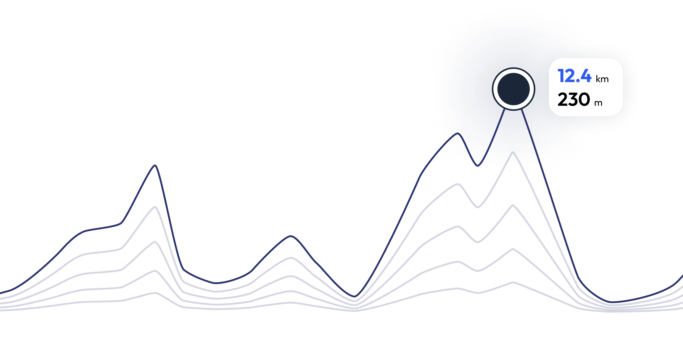
The Flying Pig Marathon - Finde dein perfektes Lauftempo 3.1 mi
Neugierig, welches Tempo du für jeden Streckenabschnitt benötigst, um basierend auf dem Höhenprofil des Rennens deine Zielzeit zu erreichen? Probiere unseren Pace-Rechner aus und entdecke verschiedene Szenarien, um deine The Flying Pig Marathon-Renntaktik gezielt zu optimieren.
Berechnete Laufzeit
00:25:00
0
km
22
m
4.33
min/km
1
km
102
m
5.12
min/km
2
km
83
m
4.47
min/km
3
km
11
m
4.23
min/km
4
km
26
m
4.32
min/km
FAQ - The Flying Pig Marathon 3.1 mi
The Flying Pig Marathon wird am 02 maj 2025 durchgeführt
The Flying Pig Marathon findet in Cincinnati, USA statt
The Flying Pig Marathon: Es gibt insgesamt 4 Strecken
Die kürzeste Strecke misst 3.1 km, und die längste 26.2 km
Obwohl es keine allgemeingültige Regel für die minimale Vorbereitungszeit gibt, empfehlen wir mindestens 12 Wochen Training für ein Rennen wie The Flying Pig Marathon
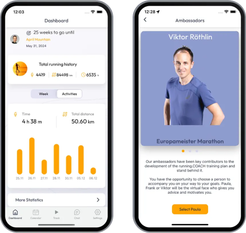
Wenn du dich auf The Flying Pig Marathon vorbereiten möchtest, bietet running.COACH dynamische Trainingspläne, die auf die Anforderungen abgestimmt sind. Egal ob du auf Distanz, Geschwindigkeit oder Ausdauer trainierst, wir haben massgeschneiderte Pläne, die dir helfen, am Renntag dein volles Potenzial auszuschöpfen.
Jetzt registrieren
Trainieren für 3.1 mi of The Flying Pig Marathon
The Flying Pig Marathon – Bereite dich mit running.COACH optimal auf deinen Wettkampf vor! Unsere Trainingspläne, unterstützt durch künstliche Intelligenz, passen sich deinem Fortschritt dynamisch an und helfen dir, deine Zielzeit zu erreichen. Egal, ob du eine persönliche Bestzeit anstrebst oder einen erfolgreichen Zieleinlauf planst – mit strukturierten Workouts, präzisem Feedback und intelligenten Anpassungen bleibst du motiviert und bestens vorbereitet. Werde Teil einer Community, die dich stärker als je zuvor ins Ziel bringt!


Was Läufer*innen über uns sagen?
Said López
running.COACH har hjälpt mig att planera hela min säsong. Jag älskar flexibiliteten med vilken träningsplanen anpassas när målen ändras. Jag är mycket nöjd med hur programmet planerar min vecka, hur exakt tempot och pulsen är och hur lätt appen är att använda. Jag tycker att dashboardet är mycket exakt och statistiken hjälper mig att hålla en tydlig överblick vecka för vecka. I år är mitt mål att nå 800 ITRA-poäng vid tre bergsultralopp i Colombia, och jag hoppas kunna göra det med hjälp av running.COACH.
Karin Stoop
Med hjälp av running.COACHs träningsprogram kunde jag uppnå målet "maraton" inom ett år med en omväxlande träningsplan som var anpassad till min prestationsförmåga. Det är imponerande hur skräddarsytt programmet är. Min dröm om att slutföra ett maraton har gått i uppfyllelse. De olika träningspassen och de märkbara framstegen är mycket motiverande.
Monika Cremosnik
Thanks to the support of my running.COACH Gold Coach, Stefanie Meyer, this year became my year of success! Intensive and always personalised training plans and always the right words and encouragement have helped me to realise my dreams. I am now a finisher in the ultramarathon in South Africa, the Comrades Marathon.
Silvia Perez
När jag först började träna med running.COACH hade jag svårt att minska intensiteten på varje träningspass. Men jag fortsatte eftersom jag tror att " färre är mer ". Med running.COACH kan jag inte bara förbättra mina tider och nå mina mål, utan jag känner mig också stark och i mycket god form. Detta gör att jag kan avsluta ett lopp nöjd och fortsätta göra det jag gillar mest: att springa!!!!
Angela Heller
"När jag började springa igen efter ett långt uppehåll stod det klart för mig att jag ville träna på ett strukturerat sätt och därför köpte jag min första prenumeration, en silverprenumeration. Jag var entusiastisk från början och min motivation ökade från träningspass till träningspass. Jag följde instruktionerna mycket noggrant och resultatet för mitt stora mål, SwissAlpine K43, blev perfekt!"
Christoph Friedli
“Tack vare en kontinuerlig träning med running.COACH kunde jag tydligt förbättra mig på alla distanser från 10 km bergslopp till marathon under de senaste åren, utan att riskera skador. Framgångarna uppmuntrar mig att sätta nya mål för mig själv.”
The Flying Pig Marathon – Sei das erste Mitglied der running.COACH-Community, das teilnimmt